FOREST LOOKOUTS
  • CALIFORNIA
  • Alameda County
    • Crane Ridge
    • Grizzly Peak
  • Alpine County
    • Leviathan Peak
    • Markleeville
    • Mt. Reba
  • Amador County
    • Mt Zion
  • Butte County
    • Bald Mountain
    • Bear Ranch Hill
    • Big Bar Mountain
    • Bloomer Hill
    • Bottle Hill
    • Brush Creek
    • Bull Hill
    • Lone Pine
    • Lookout Mountain
    • Platte Mountain
    • Rackerby
    • Sawmill Peak
    • Sunset Hill
    • Swain Hill
  • Calaveras County
    • Bear Mountain (Fowler)
    • Blue Mountain
    • Devil's Nose
    • Folsom
    • Sierra Vista (Quiggs Mountain)
    • Valley Springs Peak
  • Colusa County
    • Snow Mountain
    • Three Sisters Peak
  • Contra Costa County
    • Mt Diablo
    • Round Top
  • Del Norte County
    • Baldy Peak
    • Bear Basin Butte
    • Buck Mountain
    • Camp Six Mountain
    • High Divide
    • High Dome
    • High Plateau Mountain
    • Little Rattlesnake
    • Lookout Point
    • Monkey Creek Ridge
    • Red Mountain
    • Rock Creek Butte Point
    • Sanger Peak
    • Ship Mountain
    • Stone Corral
    • Summit Valley
    • Upper Coon Mountain
    • Youngs Peak
  • El Dorado County
    • Alder Ridge
    • Angora
    • Armstrong Hill
    • Bald Mountain
    • Baltic Mountain
    • Bayview
    • Big Hill
    • Iron Mountain
    • Jakey's Point
    • Leek Spring Mountain
    • Lookout Mountain
    • Mt Danaher
    • Peavine Ridge
    • Pilot Hill
    • Pine Hill
    • Plummer Ridge
    • Robb's Peak
    • Slate Mountain
  • Fresno County
    • Bald Mountain
    • Bear Mountain
    • Black Mountain
    • Black Mountain (Joaquin)
    • Burrough Mountain
    • Delilah
    • Fence Meadow
    • Hog Mountain
    • Joaquin Murietta
    • Lookout Peak
    • Mount Tom
    • Musick Mountain
    • Owens Mountain (Copper Peak)
    • Sentinel Ridge
    • Stag Dome
    • Weldon Point
  • Glenn County
    • Bidwell Point
    • Black Butte
    • Black Diamond
    • Long Point
    • Red Mountain
    • Sacramento NWR
    • Valley View
  • Humboldt County
    • Big Hill
    • Blake Mountain
    • Brannan Mountain
    • Broad Camp
    • Brush Mountain
    • Burrill Peak
    • Coffee Pot
    • Cold Springs
    • Eightmile
    • Grasshopper Mountain
    • Grouse Mountain
    • Iaqua Buttes
    • Lake Mountain
    • LePerron Peak
    • Mount Lassic
    • Mount Pierce
    • Pratt Mountain
    • Schoolhouse Peak
    • Shelton Butte
    • Somes Mountain
    • Sugar Pine Mountain
    • Trinity Summit
  • Kern County
    • Annette
    • Bald Mountain
    • Blue Mountain
    • Breckenridge Mountain
    • Cook's Peak
    • Grapevine Peak
    • Jasmine
    • Lost Hills
    • McKittrick Summit
    • Oak Flat
    • Piute
    • Sunday Peak
    • Tollgate
    • Wheeler Ridge
  • Kings County
    • Cottonwood Pass
    • Point La Cima
  • Lake County
    • Elk Mountain
    • Garrett Mountain
    • Goat Mountain
    • High Glade
    • Mount Konochi (Wright Mtn)
    • Pacific Point
    • Pine Mountain
    • Pinnacle Rock
    • Potato Hill
    • Sheetiron Mountain
  • Lassen County
    • Antelope Mountain
    • Blacks Ridge
    • Boyd Hill
    • Clover Valley
    • Dow Butte
    • Dyer Mountain
    • Fredonyer
    • Harvey Mountain
    • Hayden Hill
    • Ladder Butte
    • Landon
    • Lava Peak
    • Likely Mountain
    • Observation Peak
    • Pegleg Mountain
    • Seven Lakes Mountain
    • Shaffer Mountain
    • Snag Hill
  • Los Angeles County
    • Arcadia
    • Blue Ridge
    • Bodel Peak
    • Castro Peak
    • Charlie Peak
    • Glendora Station
    • Grass Mountain
    • Highline
    • Josephine Peak
    • Los Pinetos
    • Mendenhall Peak
    • Mount Gleason
    • Mount Islip
    • Mount Lukens
    • Mount Wilson
    • Oat Mountain
    • Pacoima
    • Parker Mountain
    • Pine Mountain
    • Point Dume
    • San Dimas
    • San Gabriel Peak
    • San Jose
    • San Rafael
    • San Vicente Mountain
    • Sawmill Mountain
    • Sierra Palona Peak
    • Slide Mountain
    • South Mount Hawkins
    • Sunset Peak
    • Tejon Mountain
    • Temple
    • Topanga
    • Verdugo
    • Vetter Mountain
    • Warm Springs Mountain
    • Whittaker Peak
    • Zuma
    • Henneger Flat
    • Los Angeles County Fairplex
  • Madera County
    • Castle Peak
    • Deadwood Peak
    • Goat Mountain
    • Red Top
    • Shuteye Peak
  • Marin County
    • Barnabe Mountain (Dickson)
    • Mount Tamalpais (Gardner)
  • Mariposa County
    • Guadalupe
    • Green Mountain
    • Henness Ridge
    • Miami Mountain
    • Penon Blanco Peak
    • Pilot Peak
    • Pinoche Peak
    • Signal Peak (Devils Peak)
    • Trumbull Peak
    • Williams Peak
  • Mendocino County
    • Anthony Peak
    • Cahto Peak
    • Cold Spring Mountain
    • Gualalal Mountain
    • Hull Mountain
    • Hunter Point
    • Iron Peak
    • Lookout Peak
    • Mathison's
    • Mount Sanhedrin
    • Poison Rock
    • Sherwood Peak
    • Spy Rock
    • Two Rock
  • Merced County
    • Barfield
    • Basalt Hill
    • Dickinson Hill
  • Modoc County
    • Blue Mountain
    • Blue Mountain Tree
    • Fox Mountain
    • Happy Camp
    • Lone Pine
    • Mahogany Ridge
    • Manzanita Mountain
    • Sugar Hill
    • Timber Mountain
    • Tulelake NWR (Peninsula)
    • Warren Peak
  • Mono County
    • Bald Mountain
  • Monterey County
    • Anderson Peak
    • Chalk Peak
    • Chews Ridge
    • Cone Peak
    • Junipero Serra
    • Mt. Carmel
    • Mt Toro
    • Pinyon Peak (Sid Ormsbee)
    • Pinyon Peak (US)
    • Plaskett Ridge
    • Semas Mountain
    • Smith Mountain
    • Three Peaks
    • Ventana Double Cone
    • Williams Hill (Calandra)
  • Napa County
    • Berryessa Peak
  • Nevada County
    • Banner Mountain
    • Camel's Hump
    • Cherry Hill
    • Columbia Hill
    • Grouse Ridge
    • Red Mountain
    • Wolf Mountain
  • Orange County
    • Bolero
    • Gilman Peak
    • San Juan
    • Santiago Peak
  • Placer County
    • Bunker Hill
    • Devil's Peak
    • Duncan Peak
    • Hellister Point
    • Howell Hill
    • Martis Peak
    • Mosquito Ridge
    • Stateline
  • Plumas County
    • Argentine Rock
    • Bald Eagle Butte
    • Ben Lomond
    • Black Mountain
    • Camel Peak
    • Claremont Mountain
    • Dixie Mountain
    • Kettle Rock
    • Lexington Hill
    • Mount Ewell
    • Mount Harkness
    • Mount Hough
    • Mount Ingalls
    • Pilot Peak
    • Radio Hill
    • Red Hill
    • Red Rock
    • Smith Peak
    • Spanish Peak
    • Table Mountain
    • Thompson Peak
  • Riverside County
    • Barton Peak
    • Black Mountain
    • Box Springs Mountain
    • Estelle Mountain
    • Ranger Peak
    • Red Mountain
    • Santa Rosa Peak
    • Tahquitz Peak
    • Thomas Mountain
  • San Benito County
    • Call Mountain
    • Fremont Peak
    • Hepsodan
    • North Chalone Peak
    • Sampson Peak
  • San Bernardino County
    • Butler Peak
    • Cajon Mountain
    • Cajon Summit
    • Grass Valley
    • Keller Peak
    • Little Mountain
    • Miller Canyon
    • Morton Peak
    • Mount San Antonio (Old Baldy)
    • Red Hill (Manker)
    • San Sevaine
    • Strawberry Peak
    • Sugarloaf Mountain
    • Tip Top Mountain
  • San Diego County
    • Black Mountain
    • Bottle Peak
    • Boucher Hill
    • Cuyamaca Peak
    • High Point
    • Hot Springs Mountain
    • Los Pinos
    • Lyons Peak
    • Red Mountain
    • Santa Margarita
    • Tecate Peak
    • Woodson Mountain
  • San Luis Obispo County
    • Avenales
    • Bald Mountain..
    • Black Mountain...
    • Branch Mountain
    • Caliente Mountain
    • Cerro Alto
    • Hi Mountain
    • Midway Peak
    • Rocky Butte
  • San Mateo County
    • Allen Peak
    • Mandego Hill
    • Pise Point (Kings Mtn)
  • Santa Barbara County
    • Big Pine Mountain
    • Camuesa Peak
    • Cuyama Peak
    • Figueroa Mountain
    • La Cumbre Peak
    • Los Coches Mountain
    • Madulce Peak
    • Manzanita Mountain
    • McKinley Mountain
    • McPherson Mountain
    • Mount Solomon
    • Salsbury
    • Santa Ynez
    • West Big Pine
    • Zaca Peak
  • Santa Clara County
    • Copernicus Peak
    • Eylar Mountain
    • Loma Prieta
    • Pacheco Peak
  • Santa Cruz County
    • Chalk Mountain
    • Eagle Rock
    • Saratoga Summit
    • Mount Bielawski
  • Shasta County
    • Alamine
    • Backbone Ridge
    • Bear Mountain
    • Burney Mountain
    • Grizzly Peak
    • Hat Creek Rim
    • Hirz Mountain
    • Hogback Mountain
    • Lassen Peak
    • Magee Peak
    • North Fork Mountain
    • Prospect Peak
    • Shirttail Peak
    • Soldier Mountain
    • South Fork Mountain
    • West Prospect Peak
  • Sierra County
    • Alaska Peak
    • Babbitt Peak
    • Calpine Hill
    • Crystal Peak
    • Granite Peak
    • Mills Peak
    • Poverty Hill
    • Saddleback Mountain
    • Sardine Peak
    • Sierra Buttes
    • Verdi Peak
  • Siskiyou County
    • Baldy Mountain (Happy Camp Baldy)
    • Ball Mountain
    • Bear Mountain (Siskiyou)
    • Black Butte
    • Black Fox Mountain
    • Blue Ridge
    • Bolivar
    • Buckhorn Bally
    • Bullion Mountain
    • Cecil Point
    • China Creek
    • Collins Baldy
    • Cottonwood Peak
    • Craggy Peak
    • Deadwood Baldy Peak
    • Denny Point
    • Dry Lake Mountain
    • Duzel Rock
    • Eagle Peak
    • Eagle Rock
    • Eddy Gulch
    • English Peak
    • Gazelle Mountain
    • Herd Peak
    • Hungry Creek
    • Lake Mountain
    • Lakeview Point
    • Little Mount Hoffman
    • Lower Devils Peak
    • Marble Mountain
    • Medicine Mountain
    • Mount Eddy
    • Mt. Bradley
    • Mt. Hebron R.S.
    • Offield Mountain
    • Orleans Mountain
    • Orr Mountain
    • Packers Peak
    • Paradise Craggy
    • Pony Peak
    • Round Mountain
    • Schonchin Butte
    • Slater Butte
    • Sterling Mountain
    • Ukonom Mountain
    • Van Bremmer
    • Windy Peak
  • Sonoma County
    • Big Mountain
    • Hoover (Oak Ridge)
    • Mount Jackson
    • Mount St. Helena
    • Pole Mountain
    • Red Oat Mountain
  • Stanislaus County
    • Mike's Peak (Salado Mtn)
    • Mount Oso
    • Orestimba Peak
  • Tehama County
    • Ball Mountain
    • Ball Rock
    • Beegum Peak
    • Brokeoff Mountain
    • Campellville
    • Colby Mountain
    • Digger Butte
    • Eagle Peak
    • Franklin Point
    • Greasewood Hill
    • Inskip Hill
    • McCarthy Point
    • Tomhead Mountain
    • Turner Mountain
  • Trinity County
    • Backbone Ridge
    • Billy's Peak
    • Black Rock Mountain
    • Bonanza King
    • Bowerman Peak
    • Bully Choop
    • Cabin Peak
    • Cold Springs
    • Dedrick Point
    • Dubakella Mountain
    • Eagle Rock
    • Granite Peak
    • Grizzly Mountain
    • Haman Ridge
    • Hammerhorn Mountain
    • Hayden Roughs
    • Hayfork Bally
    • Hetten Peak
    • Horse Ridge
    • Ironside Mountain
    • Kettenpom Peak
    • Lymedyke Mountain
    • Mad River Rock
    • Mary Blaine Mountain
    • Pickett Peak
    • Plummer Peak
    • Red Mountain
    • Shannon Butte
    • Slate Mountain
    • Virgin Creek Buttes
    • Weaver Bally
  • Tulare County
    • Ash Peak
    • Baker Point
    • Bald mountain
    • Blue Ridge
    • Buck Rock
    • Buena Vista
    • Cahoon Rock
    • Eshom Point
    • Gibbon Peak
    • Jordan Peak
    • Kern Peak
    • King George Peak
    • Little Baldy
    • Lookout Point
    • Milk Ranch Peak
    • Mitchell Peak
    • Mule Peak
    • Paradise Peak
    • Park Ridge
    • Shadequarter
    • Sherman Peak
    • Slate Mountain
    • The Needles
    • Tobias Peak
  • Tuolumne County
    • American Camp
    • Cave Mountain
    • Crandall Peak
    • Crane Flat
    • Darby Knob
    • Duckwall Mountain
    • Elizabeth Mountain
    • Forbay
    • Jones Point
    • Liberty Hill
    • Manzanita Point
    • McCormick
    • North Mountain
    • Pilot Peak
    • Pinecrest Peak
    • Rushing Hill
    • Smith Peak
    • Thompson Peak (Point)
    • Woods Ridge.
  • Ventura County
    • Cobblestone Mountain
    • Frazier Mountain
    • Mount Pinos
    • Nordhoff Peak
    • Reyes Peak
    • Rincon Mountain
    • Santa Paula Peak
    • South Mountain
    • Thorne Point
    • Topa Topa Peak
    • Triunfo
  • Yuba County
    • Oregon Peak
    • Pike County Peak
    • Walsh Mountain
MENDOCINO COUNTY

CAHTO PEAK

California Department of Forestry
July 10, 1934:   "The forestry department last week opened a new lookout station on the hills near Cahto.  It is to be known as Cahto Signal and will cover a large section of the country west of Laytonville.
      The forestry men have the best setup this year they have ever known in this county for fighting fires.  Up to date there have been no serious blazes, and this may be accounted for by the fact that the entire county is dotted with lookout stations, with suppression crews located at convenient places so that no fire can get much of a start without being located quickly."   (Ukiah Dispatch Democrat)


July 27, 1934:  "With the assistance of CCC employes, the federal engineers have practically completed grading the new road to the top of Cahto mountain, which is also known as Signal Peak, and rises about six miles west of Laytonville.  The new road leaves the county road in Long valley at the Purdy ranch.
     The work has been under the direction of the forestry department, which will establish a fire lookout station on top of the highest points in the county and is easily visible from the top of Windy Nook, 10 miles due west of Ukiah, and fully 35 miles south of the Signal Peak."  (Dispatch Democrat)

August 10, 1934: 
"The forestry department last week opened a new lookout station on the hills near Cahto.  It is to be known as Cahto Signal and will cover a large section of the country west of Laytonville.
     The forestry men have the best setup this year they have ever known in this county for fighting fires.  Up to date there have been no serious blazes, and this may be accounted for by the fact that the entire county is dotted with lookout stations, with suppression crews located at convenient places so that no fire can get much of a start without being located quickly."  (Ukiah Dispatch Democrat)


October 12, 1934:  "The lookout station on Cahto mountain was closed the first of the week and Jack Purdy, the lookout, has moved back to Willits with his family."  (Dispatch Democrat)

April 12, 1935:  "Emergency conservation funds have enabled the Division of Forestry, Department of Natural Resources of California, to complete the forest fire detection system in Mendocino County.  The final link in the system was the building of five and three-quarter miles of new road winding up the east side of Cahto Mountain to an elevation of 400 feet, where the new lookout tower is located.
     The lookout house has a 20-foot tower from which rangers can spot the start of a fire anywhere among thousands of acres of virgin trees, and on grazing lands."  (Oakland Tribune)

May 24, 1935:  "The private telephone line the state forestry department has been building for the past several months was connected up with the Cahto mountain lookout station last week and will also be hooked up with the Iron Peak lookout station in a few days.  Splendid progress is now being made on the line to the coast.  Frank Eberhardt, who had charge of the telephone line construction, has been promoted to the position of foreman of Camp Northwestern and M.E. Potter, who has been holding the position all winter, will resume his position as assistant forest ranger for Mendocino county."  (Dispatch-Democrat)

June 28, 1935:   "Albert Dushlilt will be installed as lookout on Cahto mountain about July 1."   (Ukiah Dispatch-Democrat)

June 6, 1945:   "C.C. Cannon, of Sherwood, will be the new lookout man on Cahto Peak this summer."   (Ukiah Republican Press)
Picture
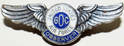
1956:   The lookout person also  held the post in Ground Observer Corps Skywatch work.
July 23, 1989:  "Fire destroyed a Lake View Drive house near here Saturday morning, a state forestry spokesman said.
     The Cahto Peak lookout spotted the fire just before 11 a.m. Saturday and reported it to the state forestry department's Howard Forest headquarters.
     Dispatched to fight the fire were three state engines and two engines from the Laytonville Volunteer Fire Department.
     The fire was contained in just 30 minutes, the spokesman said, but by then the house was a total loss."  (Ukiah Daily Journal)


1990:  This Lookout will not be staffed this fire season due to budget cuts.
Picture

National Geodetic Survey

Picture

DESIGNATION - CAHTO LOOKOUT TOWER
PID - KT2124
STATE/COUNTY- CA/MENDOCINO
COUNTRY - US
USGS QUAD - CAHTO PEAK (1967)

STATION DESCRIPTION

DESCRIBED BY COAST AND GEODETIC SURVEY 1942 (JCS)
THE STATION IS LOCATED ON CAHTO PEAK, THE HIGHEST PEAK OF
SEVERAL, LYING ABOUT 5 MILES, AIR LINE, W OF LAYTONVILLE, AND
200 YARDS W OF STATION CAHTO 1880.

THE STATION IS THE APEX OF THE LOOKOUT TOWER WHICH IS A WHITE
WOODEN FRAME STRUCTURE 14 FEET SQUARE AND 35 FEET HIGH. THIS
TOWER IS INCLOSED FROM THE GROUND UP.

STATION RECOVERY (1964)

RECOVERY NOTE BY COAST AND GEODETIC SURVEY 1964 (EHS)
THE STATION WAS RECOVERED IN GOOD CONDITION AND IS THE APEX
OF THE CAHTO PEAK LOOKOUT TOWER, A 35-FOOT HIGH, 14-FOOT
SQUARE, ENCLOSED, WHITE, WOODEN STRUCTURE, LOCATED ON THE
WEST ONE OF SEVERAL PEAKS OF CAHTO PEAK, AIRLINE ABOUT 5-1/4
MILES WEST OF LAYTONVILLE, 3-1/4 MILES NORTHEAST OF BRANSCOMB,
AND 250 YARDS WEST-SOUTHWEST OF AND SLIGHTLY LOWER THAN
TRIANGULATION STATION CAHTO 1880 WHICH IS LOCATED ON THE
HIGHEST POINT OF CAHTO PEAK.
Picture
Picture
Member:  Forest Fire Lookout Association

Picture