SISKIYOU COUNTY
*BALDY MOUNTAIN (HAPPY CAMP)
Klamath National Forest - 16N-6E-11
|

|
*BALL MOUNTAIN
Klamath National Forest - 46N-3W-25
|

|
*BEAR MOUNTAIN (SISKIYOU)
California Department of Forestry - 40N-2E-15
|

|
*BLACK BUTTE
National Forest - 41N-4W-30
|

|
*BLACK FOX MOUNTAIN
Shasta National Forest - 40N-1E-6
|

|
*BLUE RIDGE
Klamath National Forest - 10N-12W-11
|

|
*BOLIVER
Klamath National Forest - 40N-8W-33
|

|
*BUCKHORN BALLY
Klamath National Forest - 47N-8W-17
|

|
BULLION MOUNTAINKlamath National Forest - 47N-8W-2
|

|
*CECIL POINT
Klamath National Forest - 37N-11W-17
|

|
*CHINA PEAK
Klamath National Forest - 46N-12W-18
|

|
*COLLINS CREEK BALDY
Klamath National Forest - 45N-9W-1
|

|
CORY PEAKKlamath National Forest - 40N-7W-18
|

|
COTTONWOOD PEAKKlamath National Forest - 47W-7W-27
|

|
*CRAGGY PEAK
Klamath National Forest - 39N-8W-10
|

|
*DEADWOOD BALDY PEAK
Klamath National Forest - 45N-8W-7
|

|
DENNY POINTKlamath National Forest - 42N-8W-31
|

|
*DRY LAKE MOUNTAIN
Klamath National Forest -47N-9W-19
|

|
*DUZEL ROCK
California Department of Forestry - 43N-8W-36
|

|
EAGLE PEAK |

|
EAGLE ROCKKlamath National Forest
|

|
*EDDY GULCH
Klamath National Forest
|

|
*ENGLISH PEAK
Klamath National Forest
|

|
GARNER MOUNTAIN
*GAZELLE MOUNTAIN
Shasta National Forest > Klamath National Forest
|

|
GRAY BUTTE |

|
HARRINGTON PEAK
*HERD PEAK
Klamath National Forest
|

|
*HUNGRY CREEK
Klamath National Forest - 48N-8W-24
|

|
*LAKE MOUNTAIN
Klamath National Forest - 45N-11W-17
|

|
*LAKEVIEW POINT
|

|
*LITTLE MOUNT HOFFMAN
Shasta-Trinity National Forest
|

|
LOWER DEVILS PEAKKlamath National Forest
|

|
MARBLE MOUNTAINKlamath National Forest
|

|
McGAVIN PEAK
MEDICINE MOUNTAINKlamath National Forest
|

|
*MOUNT EDDY
Shasta National Forest
|
|
*MT BRADLEY
Shasta National Forest
|

|
MT HEBRON RANGER STATIONKlamath National Forest
|
|
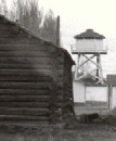 1959 - Goosenest Ranger District photo |
A combination water tower and emergency lookout.
August 2, 1935: A set of three panorama photos were taken from the lookout structure.

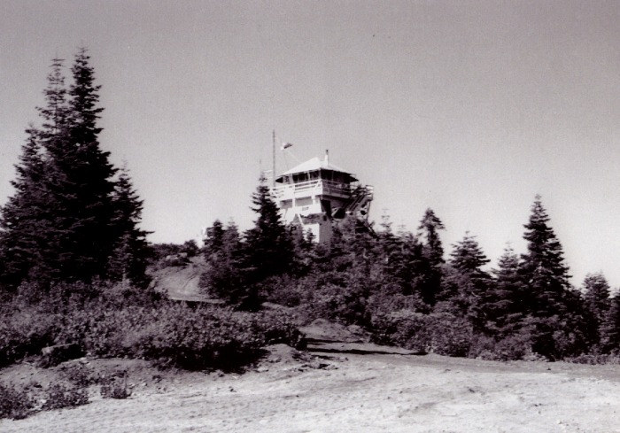
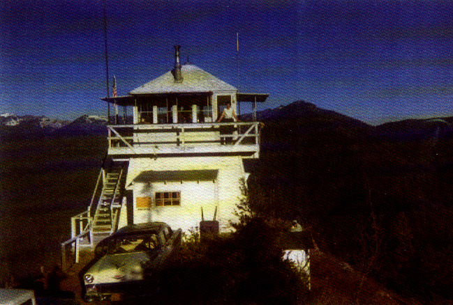
*OFFIELD MOUNTAIN
Klamath National Forest
|
|
 no date - USFS, Nancy Hood Collection |
 no date - Nancy Hood Collection
|
|
1981 - USFS, Siskiyou County Museum Collection
|
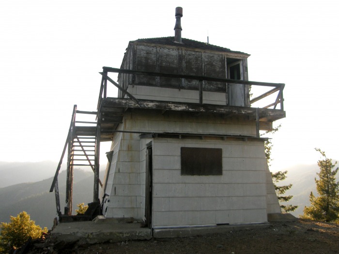
 July 2009 - Ron Kemnow photo
|
First mention was in 1919
August 1, 1928: "Offield Mt. Lookout, Steve Robinson, where it was noted that new stovepipe was needed and putty for the windows. The cab needs painting and lumber should be bought to complete the catwalk and railing. The Lookout map was checked for orientation by making readings on mirror flashes from Baldy Mt. and Orleans Mt. The trail crew has cut the trees from around the lookout for better visibility. Lightning protection was absent on the telephone line." (3)
November 20, 1933: "Morford moved to Orleans CCC Camp and with 5 man crew packed into Offield Lookout and camped in the old building while finishing the new tower and cab. Spent Thanksgiving on the job." (4)
July 25, 1935: The road to Offield Lookout and Camp 3 is now completed." (4)
1942: The Aircraft Warning Service used the Lookout station as an observation post during the winter months.

*ORLEANS MOUNTAIN
Klamath National Forest
|

|
*ORR MOUNTAIN
Klamath National Forest
|

|
*PACKERS PEAK
Klamath National Forest
|

|
*PARADISE CRAGGY
California Department of Forestry
|

|
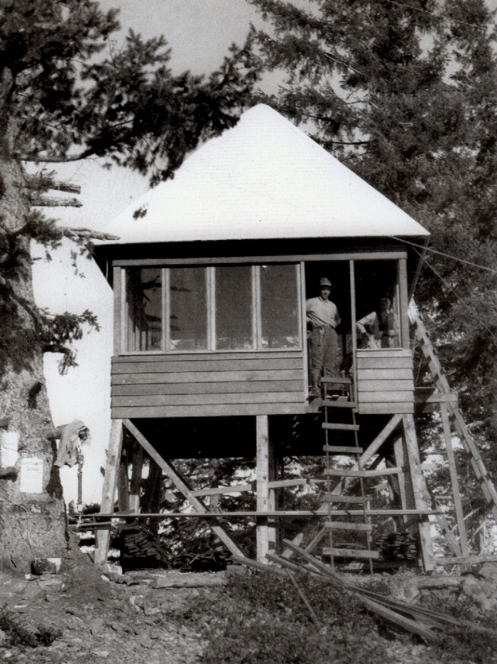
*PONY PEAK
Klamath National Forest
|
|
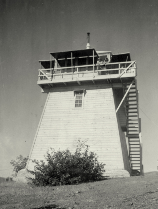
 no date - USFS, Nancy Hood Collection |
1925 - USFS, Siskiyou County Museum Collection
|

1914
December 16, 1924: "Rangers Carter and Hickey will replace the emergency wire to Pony Peak Lookout with number 9 wire." (3)
July 5, 1928: "Pony Peak Secondary Lookout. Manned in emergencies from Aubreys at Cottage Grove. This should be a primary Lookout. A telephone line has been built to the peak by contributed guard time." (3)
1934: The Lookout construction was completed by CCC crew. (4)

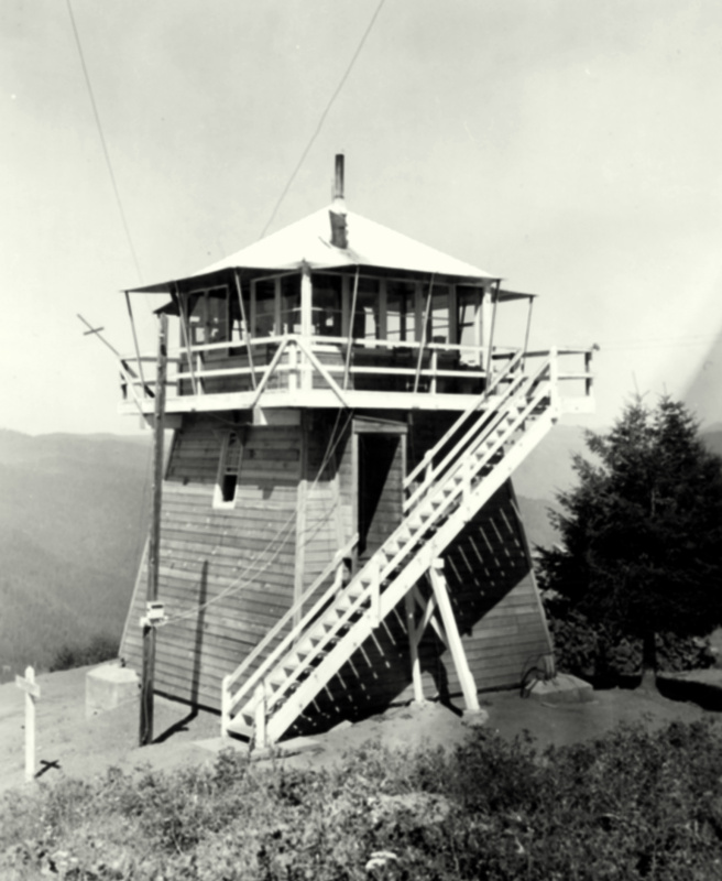
*QUARTZ HILL
California Department of Forestry
|
|
|
no date - USFS, Siskiyou County Museum Collection
 1940 - USFS, Nancy Hood Collection |
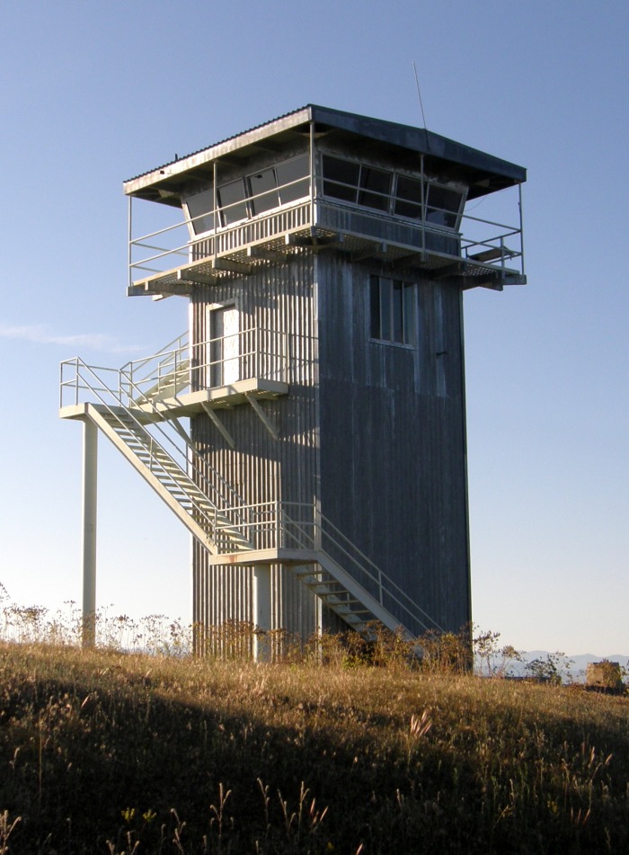 June 2009 - Ron Kemnow photo
|
1933: The CCC constructed a road to the Quartz Hill lookout. (4)
May 7, 1934: "(Hill Diary) Went to Spring Flat CCC Camp and picked up six men and went to Quartz Hill Lookout site to dig holes for tower piers. I hauled sand and gravel from Greenview, made six loads. Continued work on Quartz Hill Lookout pier holes, latrine and garbage pit." (4)
August 24, 1934: "The Klamath Forest secured an easement for the Quartz Hill Lookout site." (4)
1934: The Lookout construction was completed by CCC crew. (4)
1942: The Lookout station was used during the winter as an Aircraft Warning Service observation post.
February 5, 1953: "Jack Short retired January 31 after 16 years as a lookout on the Klamath National Forest. He was stationed on Quartz Hill." (6)

*ROUND MOUNTAIN
Modoc National Forest
|

|
*SCHONCHIN BUTTE
Lava Beds National Monument
|

|
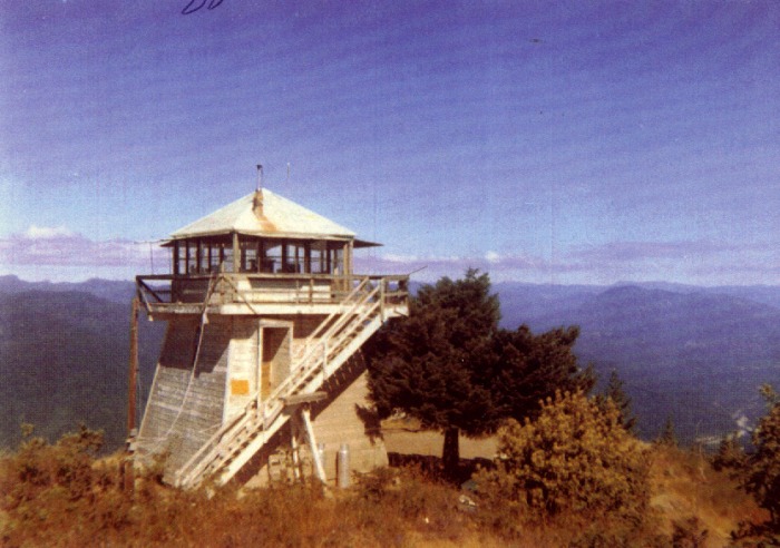
*SCOTT BAR MOUNTAIN
Klamath National Forest
|
|
|
no date - USFS, Siskiyou County Museum Collection
|
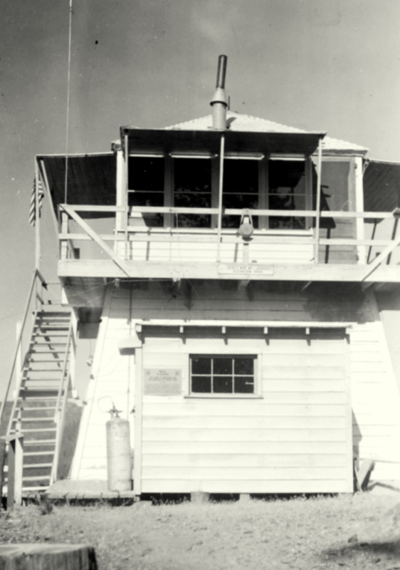
 no date - Nancy Hood Collection* |
 June 2009 - Ron Kemnow photo
|
May 1, 1934: "(Hill Diary) On duty at the Spring Flat CCC Camp. Took fifteen men to Scott Bar Mountain Lookout site and started leveling for foundations. Put three men to digging out spring for lookout water supply. Walt Gillis made two pack trips with sand. Continued working on Lookout and spring on the 2nd and 3rd and 4th and returned to Scott Bar with John Williams." (4)
May 15, 1934: "(Hill Diary) Work with Sam Potter, and help build base forms and get one pier poured, with John, Lee and Jack. Poured two more piers the next day. Next day finished piers and poured floor of tower. The carpenter left. We stayed overnight and then, on the 18th, worked trail from Lookout site to Spring Flat." (4)
1934: The Lookout construction was completed by CCC crew. (4)
1942: The Aircraft Warning Service used the lookout station as an observation post.

SECRET SPRINGS MOUNTAIN |
|
*SLATER BUTTE
Klamath National Forest
|

|
STERLING MOUNTAINKlamath National Forest
|

|

*TULELAKE NWR HEADQUARTERS
|
|
 August 2008 - Ron Kemnow photo |
1937: The 100-foot Aermotor tower was removed and a rock observation structure was constructed on the bluff behind the refuge headquarters. The new structure, constructed by the CCC, was designed to use native material and to blend in with the surrounding landscape. The Aermotor was moved to the Upper Klamath Refuge and re-erected as a observation post to watch for poachers.

*UKONOM MOUNTAIN
Klamath National Forest
|

|
*VAN BREMMER
Klamath National Forest
|

|
*WINDY PEAK
Rogue River National Forest - 48N-11W-28
|

|

____________________
Numbered sources
(1) Chronological History of the Klamath National Forest, Vol. I, 1905-1910 (A collection of diary entries and other records
(2) Chronological History of the Klamath National Forest, Vol. II, 1911-1920 compiled by R. Bower, USFS Ret.)
(3) Chronological History of the Klamath National Forest, Vol. III, 1921-1930
(4) Chronological History of the Klamath National Forest, Vol. IV, 1931-1940
(5) Chronological History of the Klamath National Forest, Vol. V, 1941-1950
(6) Chronological History of the Klamath National Forest, Vol. VI, 1951-1955
(7) Chronological History of the Klamath National Forest, Vol. VII, 1956-1958
(8) Chronological History of the Klamath National Forest, Vol. VIII, 1959-1960
